
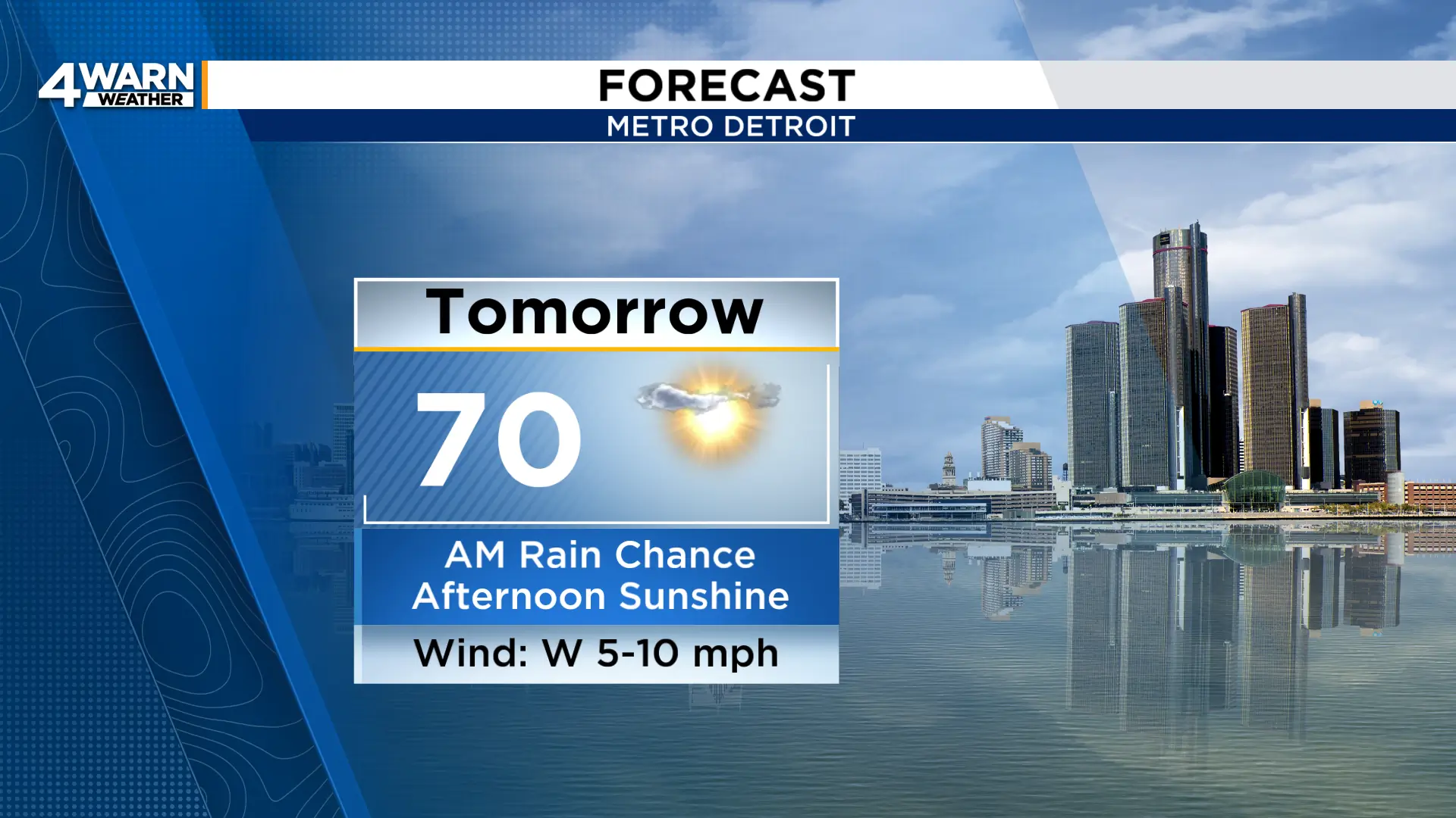
4Warn Weather - High pressure brought plenty of sunshine to Southeast Michigan Saturday. As a front moves through the state Sunday, there will be a small chance to run into some rain in the morning before returning to pleasant afternoon conditions.
We’ll see a few clouds this evening with temperatures falling through the 50s. It’ll be cool tonight with most areas in the 40s, but a few upper 30s can’t be ruled out for our northernmost neighborhoods.
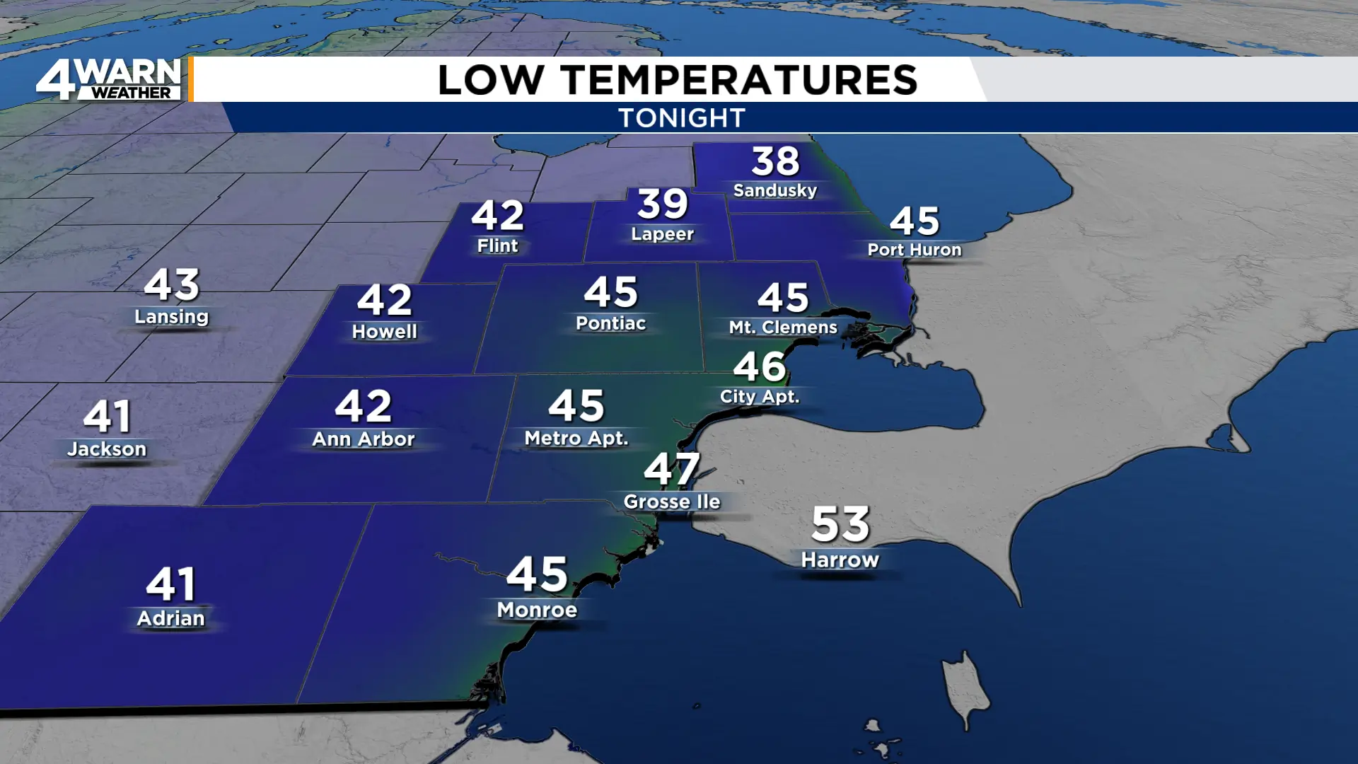
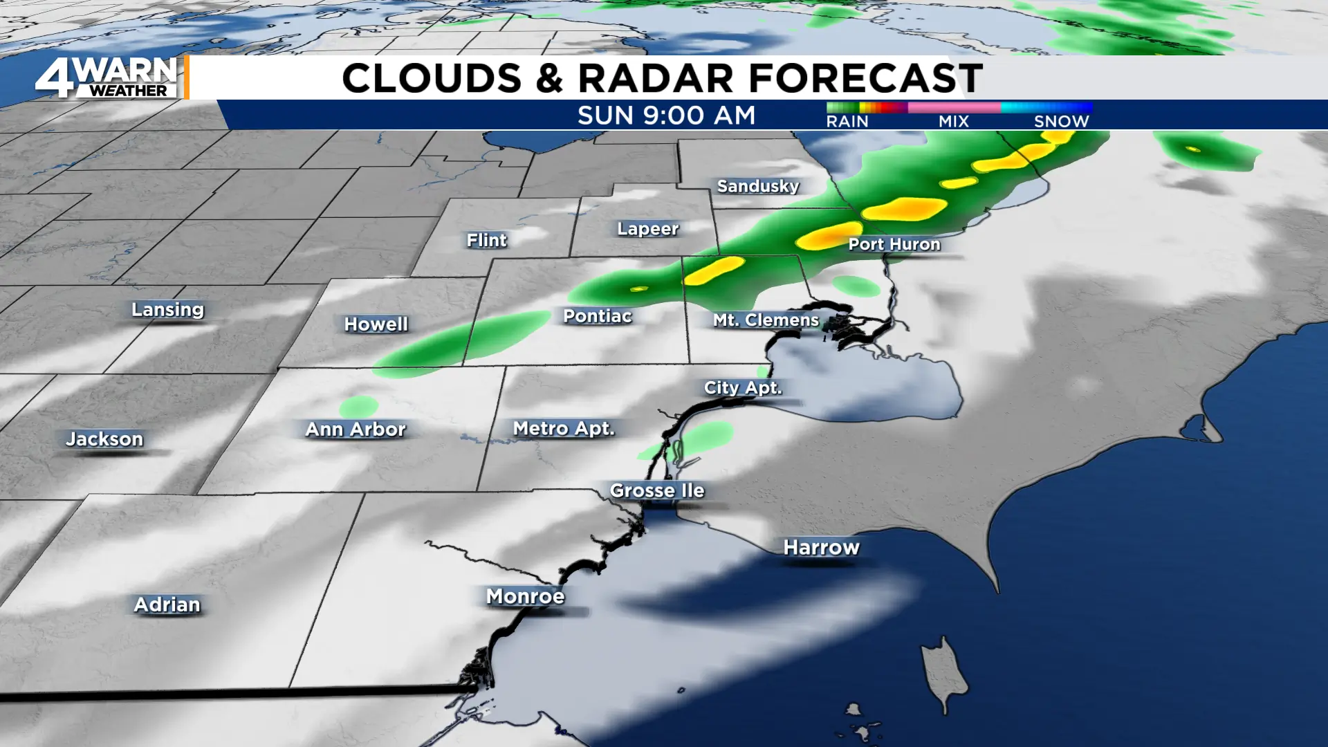
Skies will be mainly clear with a light wind before some clouds move in early Sunday morning. There will be a slim chance to see rain Sunday morning, especially north of Detroit and between the hours of 7 a.m. and 10 a.m.
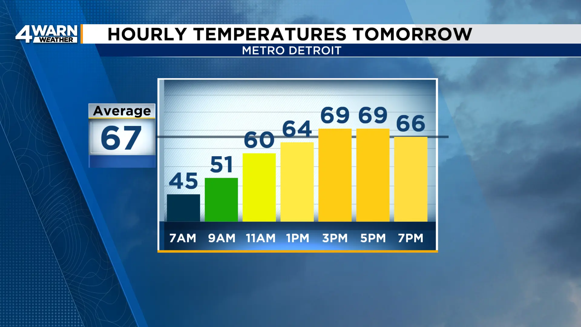
Afterward, Sunday afternoon will feature the return of sunshine and highs around 70°.
Our weather will be much nicer than what they’ll be seeing in Charlotte. Fans headed to see the Lions take on the Panthers in North Carolina may want to bring the raincoat or poncho. Temperatures will be in the mid 60s but there is the chance for rain throughout the game.
Back here at home we’ll be cooler to start the upcoming workweek with highs only in the low 60s Monday and Tuesday.
Morning lows will be in the low to mid 40s, with 30s possible Tuesday morning.
We’ll still have lots of sunshine, and that will continue for Wednesday as we warm to around 70°.
We look to keep highs near 70° to finish the week, remaining dry into the weekend.
