
4Warn Weather – Showers and thunderstorms will continue to develop across Southeast Michigan Tuesday as a cold front settles into the region, bringing a low-end severe weather threat along with the potential for locally heavy rain.
The best chance for thunderstorms will generally be along and south of M-59, including much of Metro Detroit.
An isolated storm could become strong through midnight. Gusty winds and heavy rain are the primary concerns.
Storms will generally move from west to east at around 40 mph.
The overall severe weather threat is limited because instability is not particularly strong.
However, there is enough wind shear and moisture available for a stronger storm to briefly organize.
As the atmosphere becomes more stable overnight, the threat of strong storms will diminish.
Showers and thunderstorms will remain possible, however, especially during the late evening and overnight hours.
Heavy rain becomes a greater concern overnight.
The atmosphere contains plenty of moisture, and repeated showers or thunderstorms could produce locally heavy rainfall.
Rain chances remain high overnight, with temperatures falling into the mid- to upper 60s.
Rain lingers into Wednesday
Wednesday will begin cloudy and damp, with additional showers and a few thunderstorms possible through the morning.
Strong storms are not expected Wednesday.
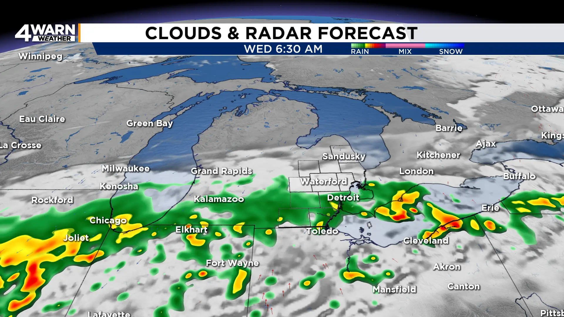
Rain coverage should gradually decrease by the afternoon, although a few showers could linger.
Temperatures will be cooler than recent days, with highs generally in the mid-70s.
Clouds will be stubborn through much of the day as cooler northeast winds off Lake Huron help maintain a low cloud deck.
Another round of showers is possible Wednesday night into Thursday as the frontal boundary remains nearby.
Thursday will stay mostly cloudy with a chance of showers, especially during the first half of the day.
Highs will reach the upper 70s.
Brief break Friday before a wetter weekend
Friday currently looks like the best opportunity for a break in the rain. Partly sunny skies are possible with highs in the mid-70s.
The dry stretch may not last long.
Another system approaching from the Plains could bring showers and thunderstorms back to Michigan on Saturday.
Rain may become more widespread during the afternoon and evening, although there remains some uncertainty over where the heaviest rain will ultimately develop.
Saturday and Sunday both look mild but unsettled, with highs generally in the low to mid-70s and periodic showers.
Rain chances could continue into Monday before somewhat drier weather returns by Tuesday.
Tuesday also marks the autumnal equinox and the official beginning of astronomical fall.
Share your weather photos with Local 4 at MIPics.
