
4Warn Weather – Keep the umbrella close late Wednesday night as another round of showers moves through Southeast Michigan, especially across the southern half of the region.
A stalled frontal boundary near the Michigan-Ohio state line will remain close enough to support additional showers overnight and into Thursday.
A thunderstorm cannot be ruled out, but severe weather is not expected. Strong storms will remain south of Michigan.
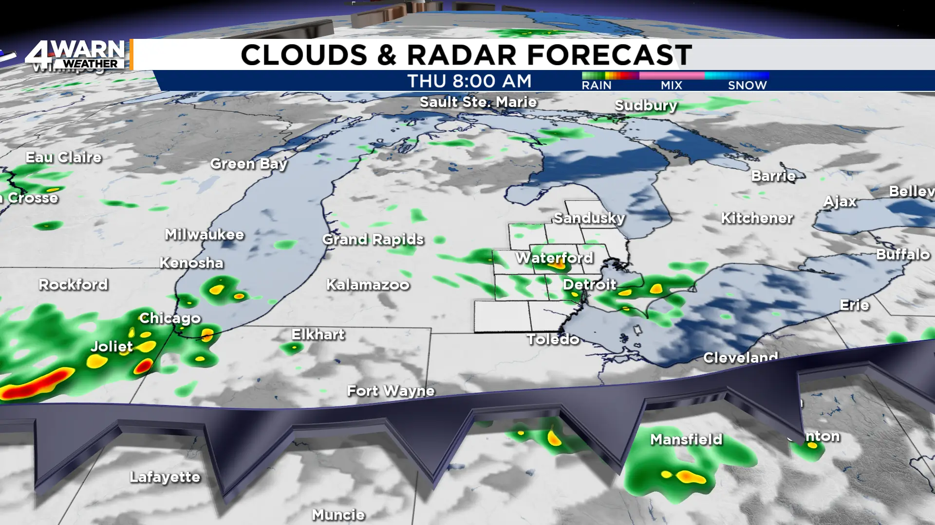
Temperatures will fall into the upper 50s and lower 60s overnight, with plenty of clouds lingering into Thursday.
A few showers may continue Thursday, particularly south of M-59, before drier air begins to push into the region later in the day.
Highs will reach the mid-70s.
Big night for bird migration
Wednesday night is expected to be active for fall migration, with more than 4 million birds forecast to fly over Michigan.
The numbers jump considerably Thursday night, when the forecast calls for nearly 13 million birds statewide, including roughly 30,000 over Detroit.
That difference is very likely tied in part to the changing weather pattern.
Many migratory birds travel at night and tend to take advantage of favorable conditions, especially drier weather and supportive winds.
Wednesday night remains cloudier and more unsettled, with showers still moving through parts of the state.
By Thursday night, high pressure begins building in, precipitation fades, and winds become lighter, creating a more favorable window for migration.
The numbers reflect how many birds are expected to move on a particular night, and weather can strongly influence when they choose to take flight.
With migration increasing, residents and businesses can help birds by turning off unnecessary exterior lighting and dimming indoor lights near windows overnight.
Artificial light can attract and disorient migrating birds, particularly in urban areas.
Friday looks like the pick of the stretch
Friday brings the best chance for a dry break before the weekend turns wetter.
Expect some sunshine with highs in the low to mid-70s and relatively comfortable humidity.
The National Weather Service expects high pressure to provide a short-lived dry period Thursday night into Friday.
That timing is good news for the Local 4 High School Football Game of the Week Friday evening.
Trenton travels to Gibraltar Carlson for a 7 p.m. kickoff.
At this point, Friday evening looks mainly dry, although clouds may begin increasing later at night ahead of the next weather system.
Widespread rain returns Saturday
The dry stretch does not last long.
A stronger system approaching from the Plains will spread widespread showers into Southeast Michigan Saturday.
The National Weather Service says rainfall totals of more than a half-inch are likely, with some locations having the potential to receive an inch or more from Saturday afternoon into Saturday night.
A thunderstorm or two will also be possible, but the main concern at this point is periods of heavy rain.
Highs Saturday will stay in the lower 70s.
Showers may linger into at least part of Sunday before becoming more scattered. Temperatures remain seasonably mild, generally near 70 degrees.
There is still some uncertainty about whether another more substantial round of showers develops Sunday or Monday as another upper-level disturbance passes through.
Fall officially arrives Tuesday
The calendar catches up with the changing weather next week.
The autumnal equinox arrives Tuesday, Sept. 22, at 8:05 p.m. EDT, marking the astronomical beginning of fall in the Northern Hemisphere.
Monday and Tuesday may still feature occasional shower chances, with highs around the upper 60s to lower 70s.
By Wednesday, conditions currently appear somewhat drier, with temperatures remaining close to 70 degrees.
Have any nature and weather photos? Share them with Local 4 at MIPics.
