
4Warn Weather – High pressure to the north will help to bring us a brief break in the rain.
A low-pressure system moves in from the Plains this weekend, bringing widespread showers to the Great Lakes.
Light drizzle and mist are possible overnight as temperatures fall into the 50s across most of the area.
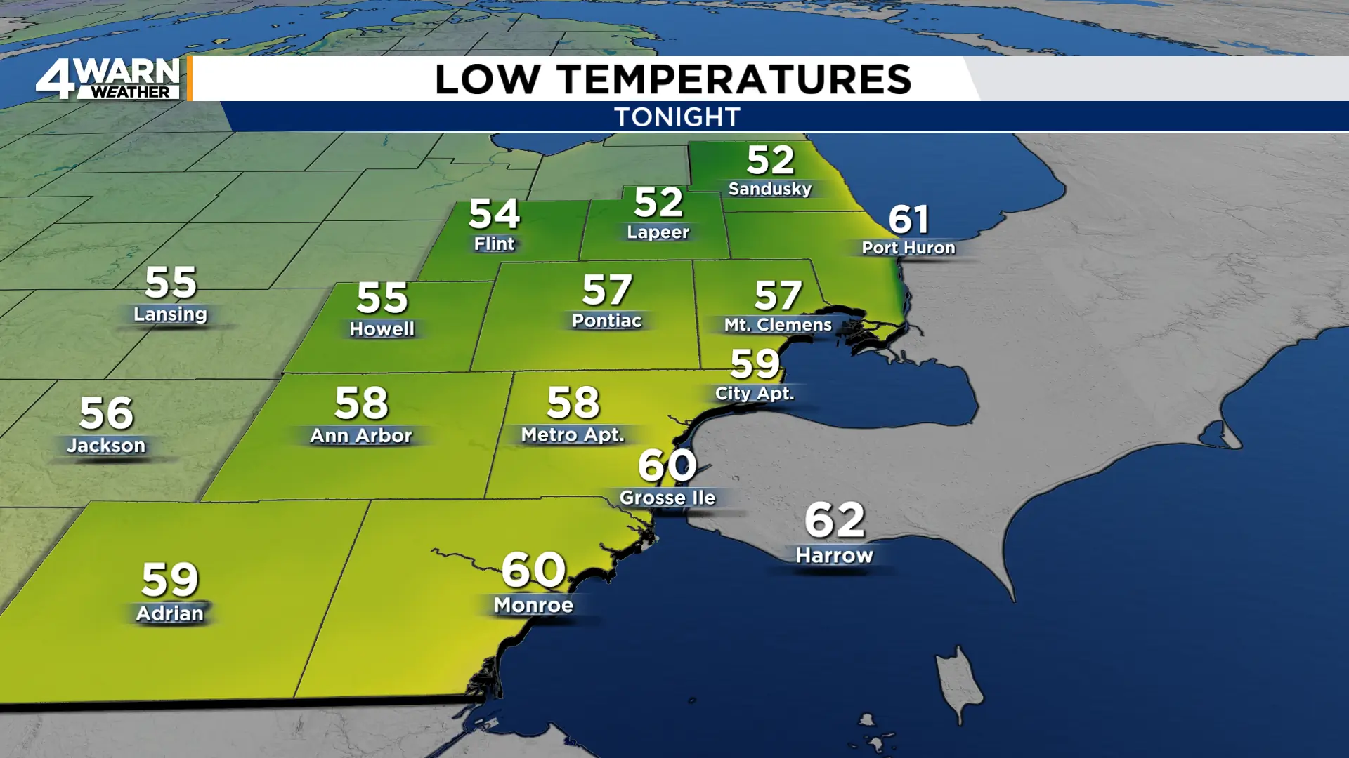
We’ll see a mix of sun and clouds during the day Friday with highs near normal in the low 70s.
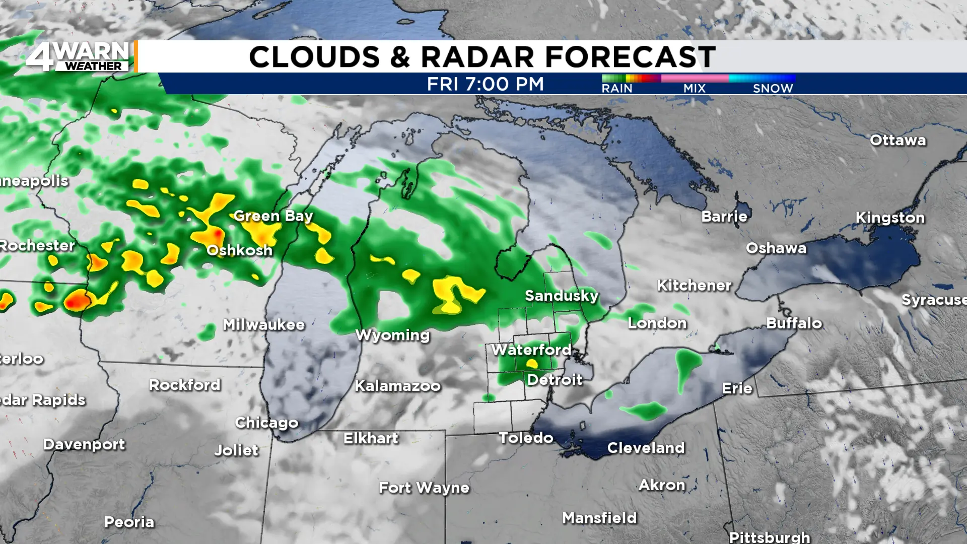
Scattered rain will be possible Friday evening before widespread rain moves in Saturday morning.
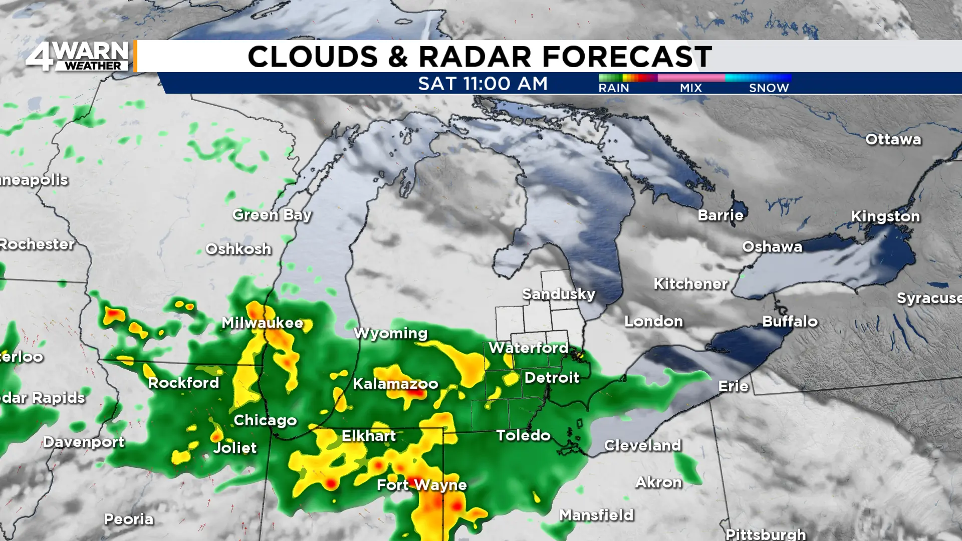
Rain will be heavy at times throughout the day Saturday and Saturday night.
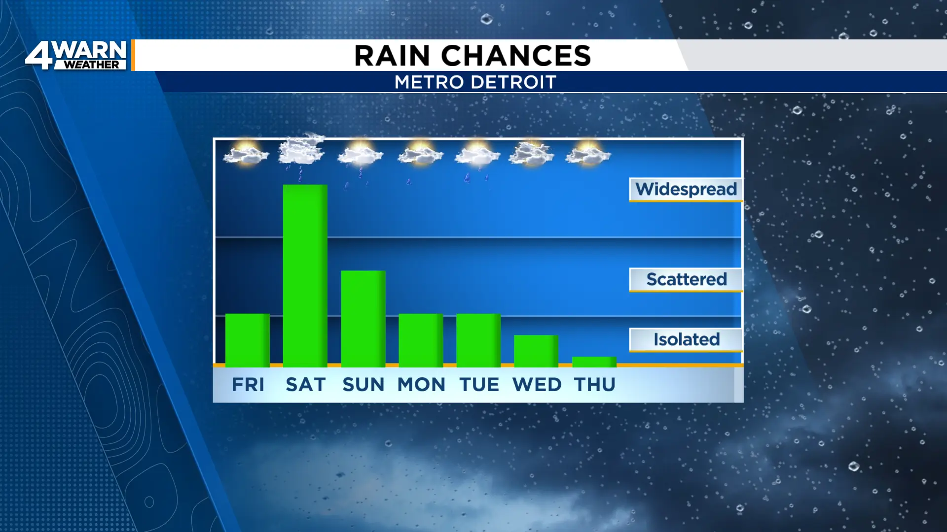
Widespread rain will linger into Sunday before moving out. By then, most will have picked up 0.5″ to 1.5″ of rainfall.
Scattered rain chances then carry into the coming week.
Temperatures will be cooler as well.
After seeing the 70s Friday, highs Saturday and Sunday will remain in the upper 60s ahead of cooler weather starting the workweek.
