
4Warn Weather - High pressure to the north will keep Southeast Michigan dry for most of the day today. A low pressure system moving in from the Plains will bring the chance for rain this evening and widespread rain this weekend.
Today’s highs will be near normal in the low 70s.

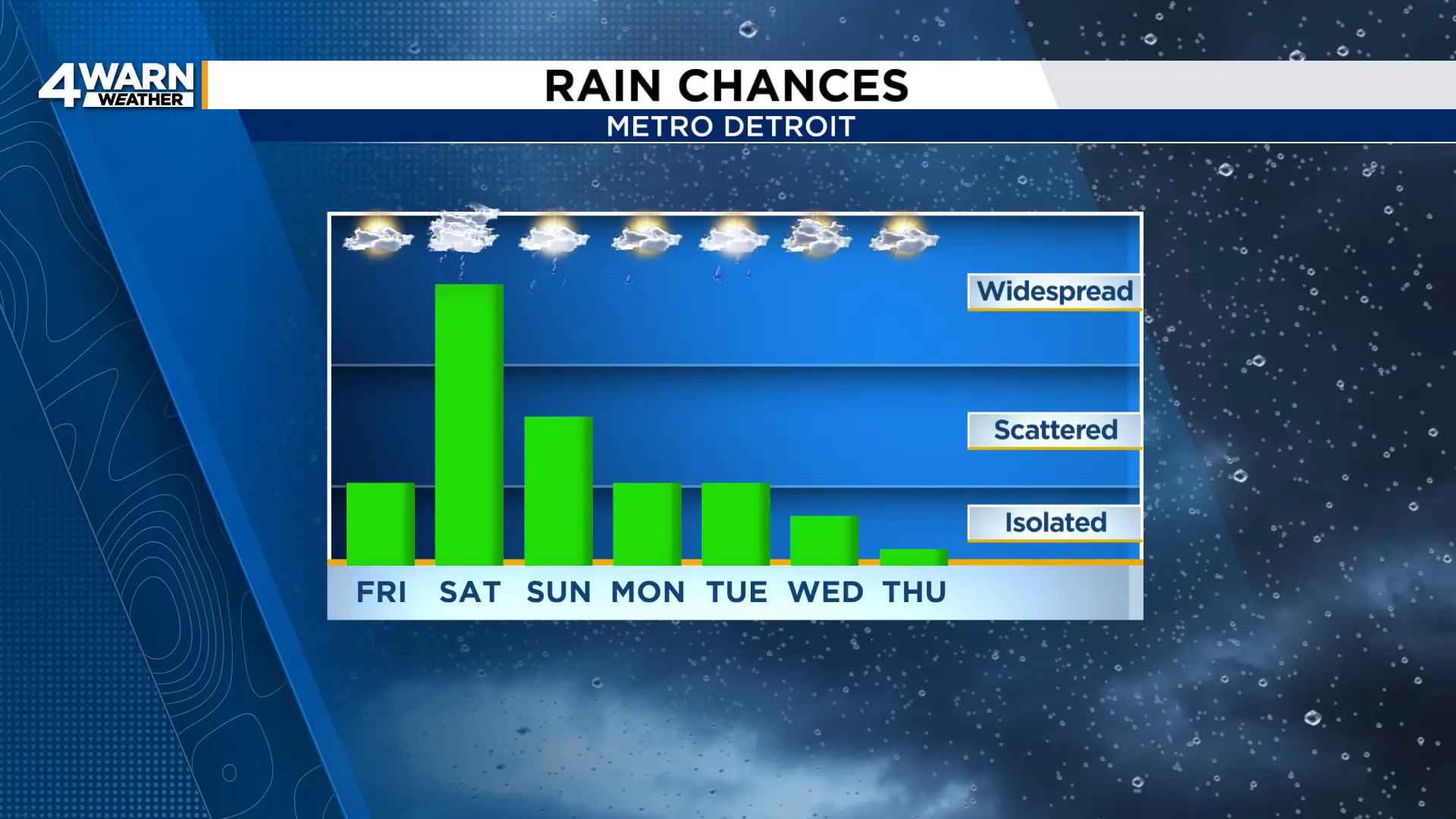
We’ll see a mix of sun and clouds, and you’ll want to get outside and enjoy the dry weather. Isolated showers will be possible Friday evening, so although it’s a better chance you stay dry, you may want to bring the raincoat or umbrella to those Friday night football games just in case.

Scattered rain will be possible overnight but most will remain dry. Low temperatures will fall to the mid 50s across most of the area.

Widespread rain moves into Southeast Michigan early Saturday morning, continuing through midday, heavy at times.
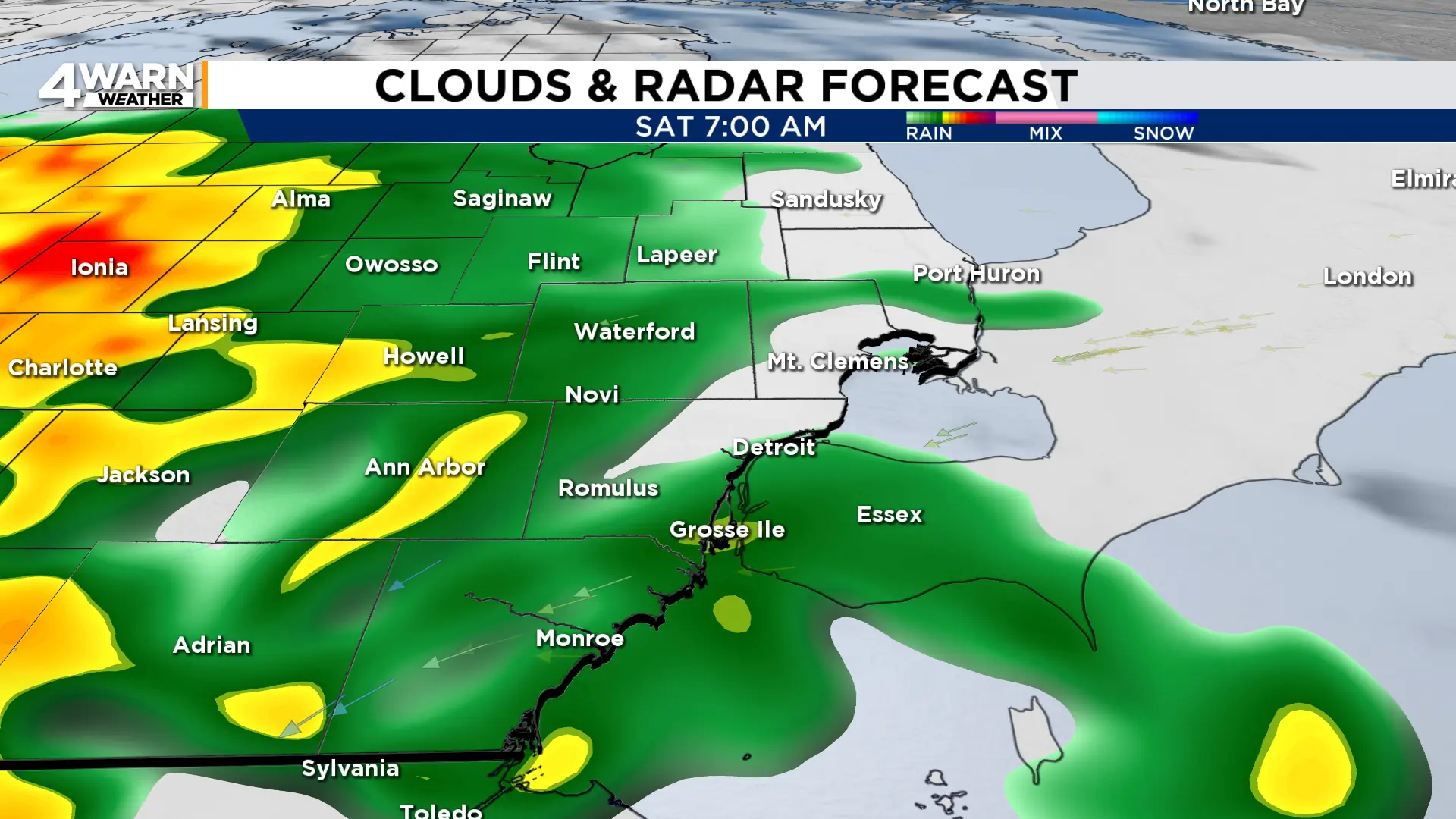
Rain becomes scattered in the afternoon, remaining that way overnight before widespread rain returns Sunday morning.
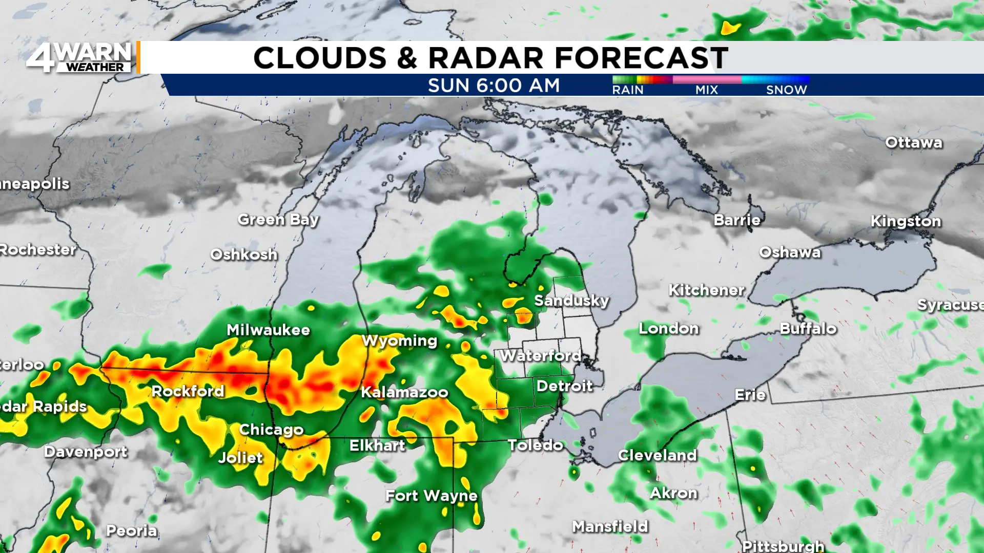
Rain will then become scattered again later Sunday.
Overall rainfall totals look to be around 0.5″ to 1.5″ for most locations, but locally higher amounts are possible.
Rain chances will linger into Monday and Tuesday.
Along with the rain, temperatures will stay cooler. Highs this weekend will be in the mid to upper 60s before we fall to the low 60s into the coming workweek.
