
4Warn Weather – The normal high temperature this time of year in Metro Detroit is 73°, and we’ll be well below that to start the workweek. We do finally start to warm up toward the end of the week, seeing the comeback of more sunshine.
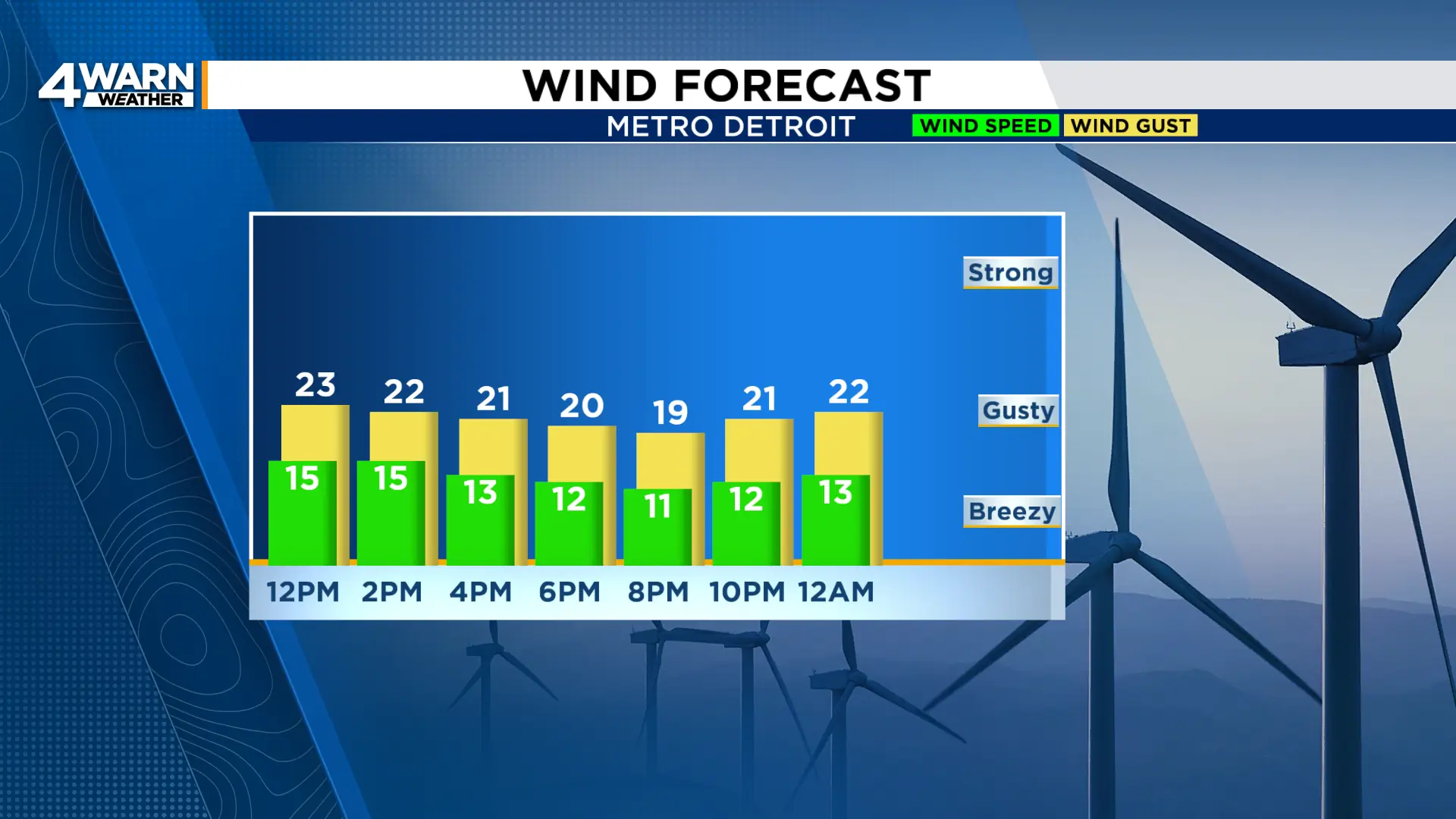
Highs today will only be in the lower 60s with a breezy northeast wind at 10-15 mph, gusting into the mid 20s at times.
We’ll spend the day mostly cloudy to overcast with the chance of a few showers, particularly closer to the I-94 corridor and southward, this afternoon and evening.
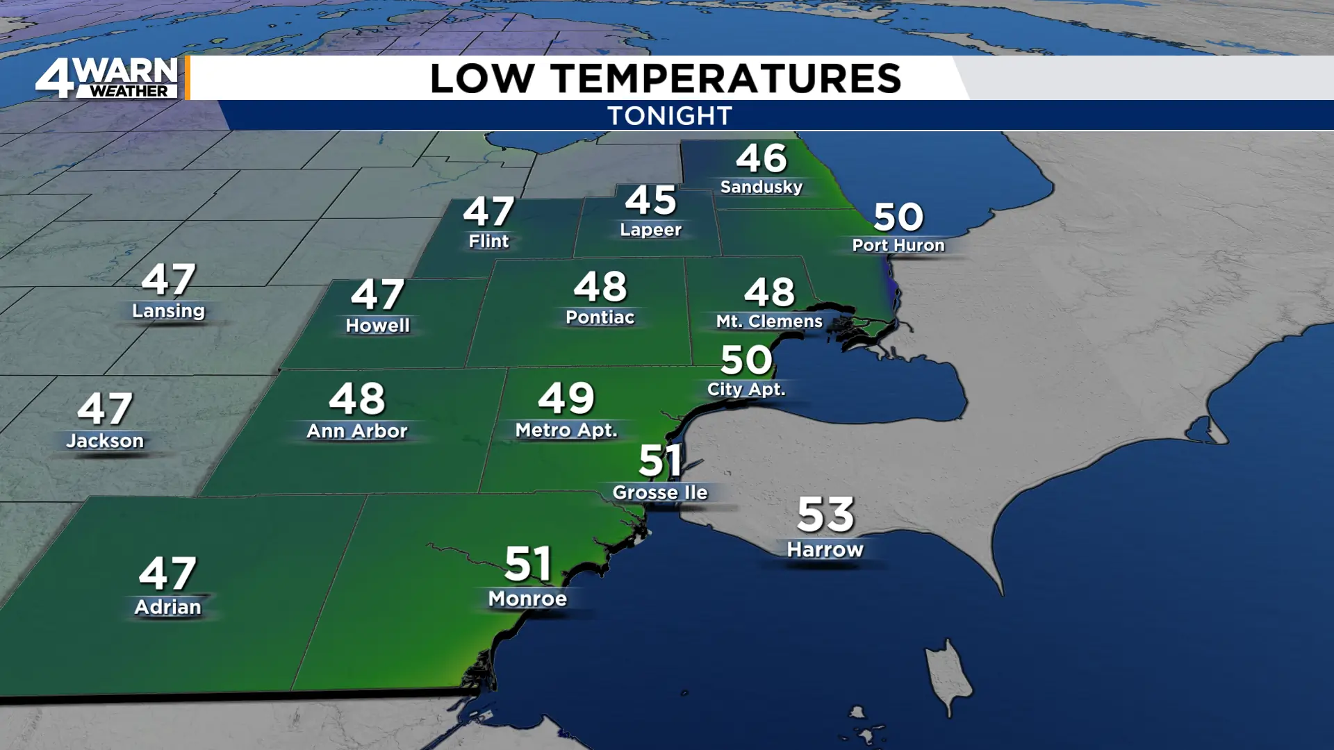
Tonight we’ll see some breaks in the clouds with overnight low temperatures falling to the mid 40s to near 50°.
Northeast winds stay up with us overnight and through tomorrow, adding that extra chill to the first day of Fall. We officially start Fall at 8:04 p.m. Tuesday.
Highs Tuesday and Wednesday will remain in the low 60s. You might catch a little sun through the clouds, but we’ll see the chance of rain later Tuesday into Wednesday.

Southeast Michigan looks to dry out starting Thursday with more sunshine expected into the weekend.
We slowly start to warm, seeing highs in the mid 60s Thursday and Friday go up to around 70° for the weekend.
